Popolopen Torne
Region: Hudson Valley (Harriman - Bear Mountain State Park)
Level: Moderate
I hiked Popolopen Torne, a small but at times challenging mountain in the Harriman - Bear Mountain State Park region on Sunday, March 4th. Besides the interesting name, the Torne is a great little trip that hikers can turn into a full day should they please. Myself, I turned what was supposed to be a quick hike into somewhat of a long (partly lost) journey.
UPDATE: June 2019 - Took another trip to Popolopen Torne in the evening on a nice Saturday. Always a great view and the amazing memorial to our Troops who’ve passed away protecting our freedoms is always my favorite part. Freedom isn’t free and we all need to remind ourselves this every day.
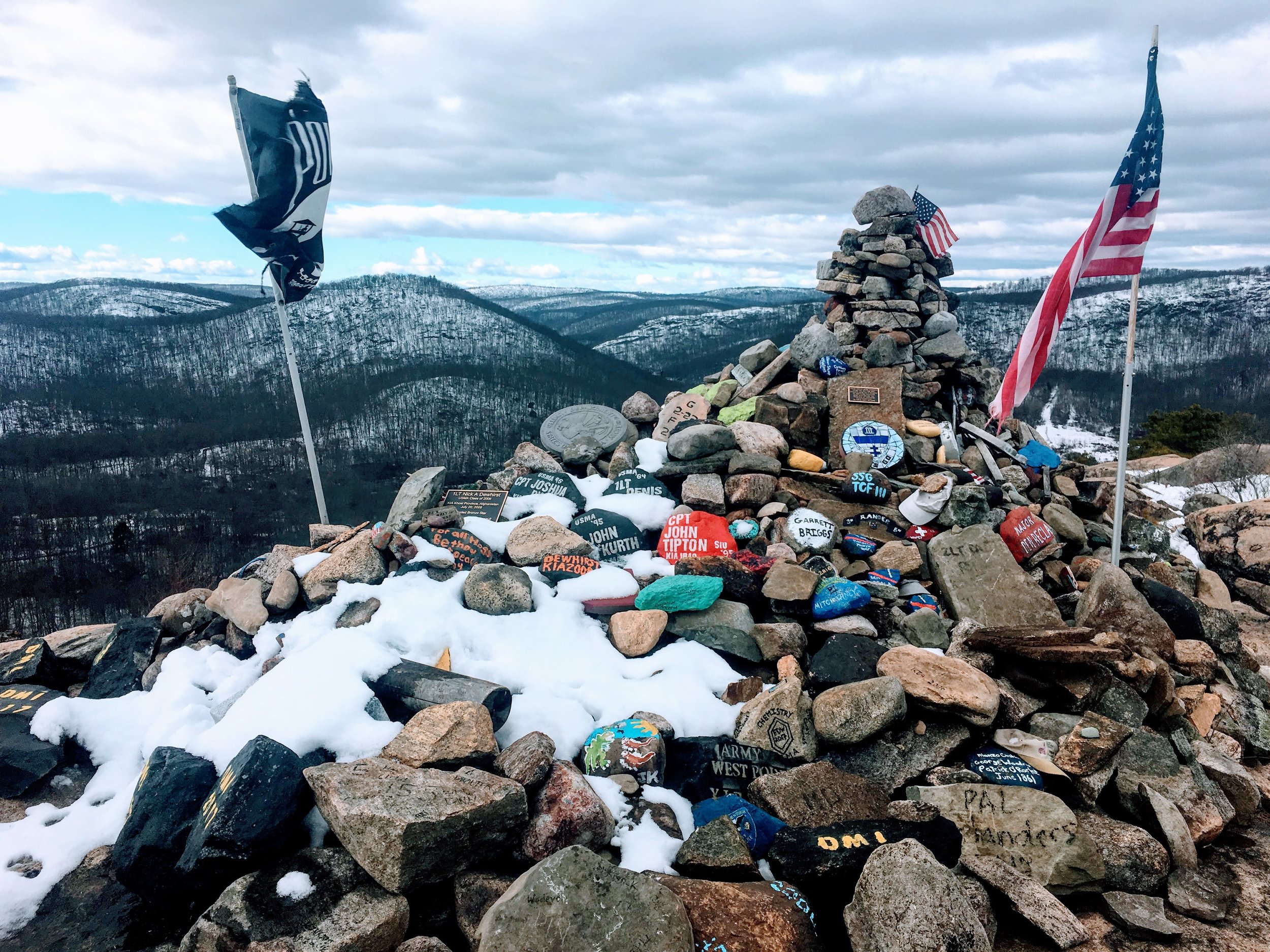
Popolopen Torne summit shot. Notice the memorial cairn on the right, which I discuss briefly in the post.
"The Torne," which I've heard the locals refer to it as, is located within the Harriman - Bear Mountain State Park area in Highlands, NY. For trail reference, click here. As you may know from my post on Bear Mountain, my route to this trail was the same: Metro-North to Peekskill, Uber to the trailhead. Next time I do this I'll probably try to start at a lower trail, but I asked the Uber driver to bring me to the Popolopen Torne parking lot, which leaves you off right at the Timp Torne Trail (on map it's TT, blue). From here, you'll be right on the main mountain hike trail, and though it'll get steep in some spots, it's relatively moderate overall. The loop up and down if you were to go right back to the parking lot is only about 1.5 miles (930 ft. elevation). Stopping for photos and a few breaks, the loop is only 1-1.5 hours.
Bear Mountain bridge in the background. That's also the base of Anthony's Nose on the east end of the bridge.
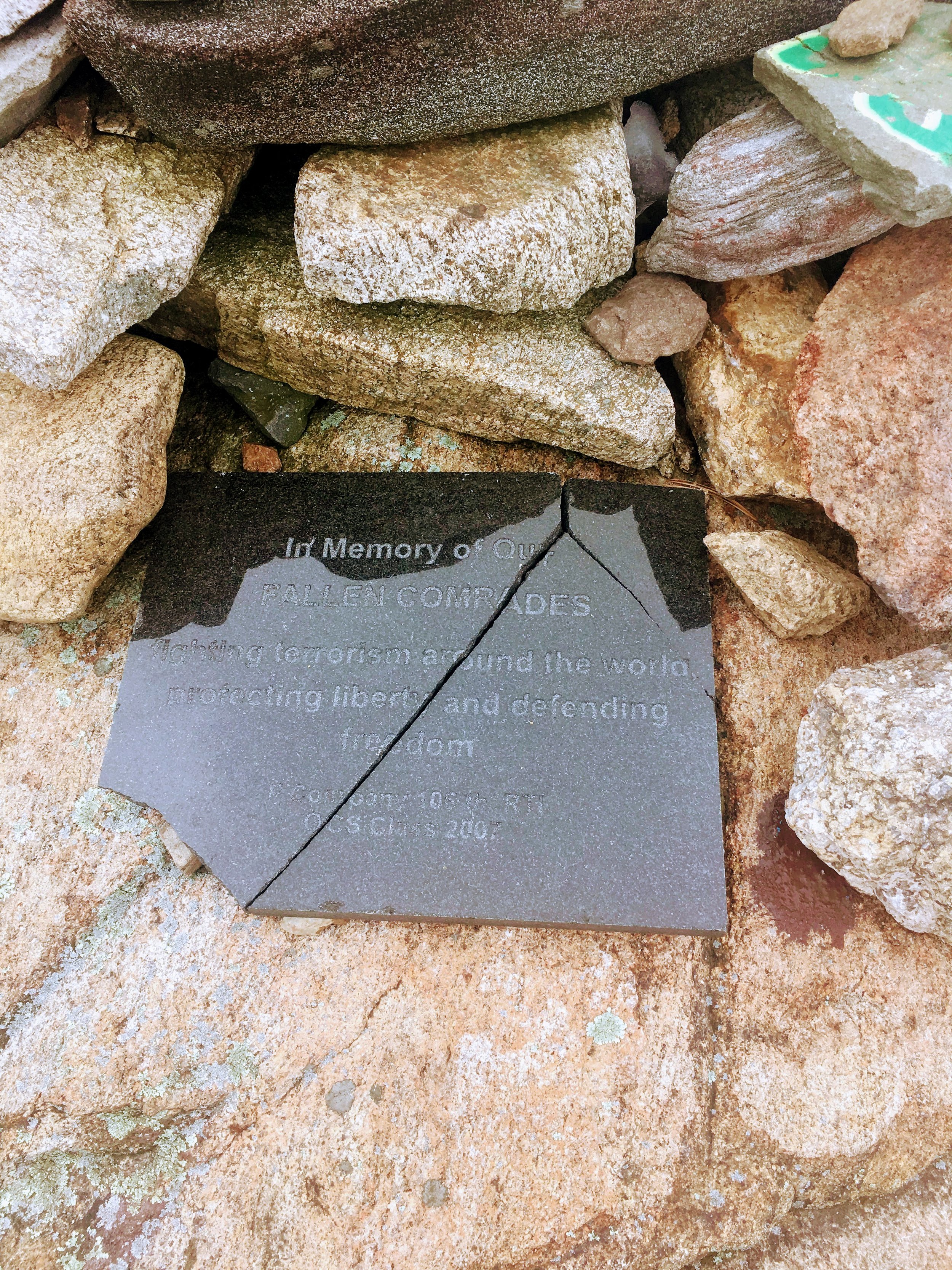
The top has panoramic views, plus a great tribute and memorial to our US military, specifically focused on those that have fought, as well as have made the ultimate sacrifice, in Afghanistan, Iraq and the broader middle eastern theater of war. The memorial consists of memorial benches, plaques, and a rock cairn listing the names of those brave military men and women. At the start of the Timp Torne Trail, there is a plaque which gives some background. A few lines for reference: "Shortly after the Twin Towers were knocked down, an old Soldier started carrying rocks to the top of the Torne. The Rocks were a tribute to Service members in harm's way; a tangible symbol of a wish for their safe return. Soon others brought stones to honor those that would never return; those that gave their life so others might have a chance to live free." This is a small snippet of the background. It's a very strong symbol of American pride, and I'm glad it exists and hope that the cairn continues to inspire hikers as they pass by and pay tribute at the summit.
Cairn tribute
"These rocks were carried from the bottom and stacked here as a tribute to American soldiers now serving on the Frontier of Freedom. To their safe return."
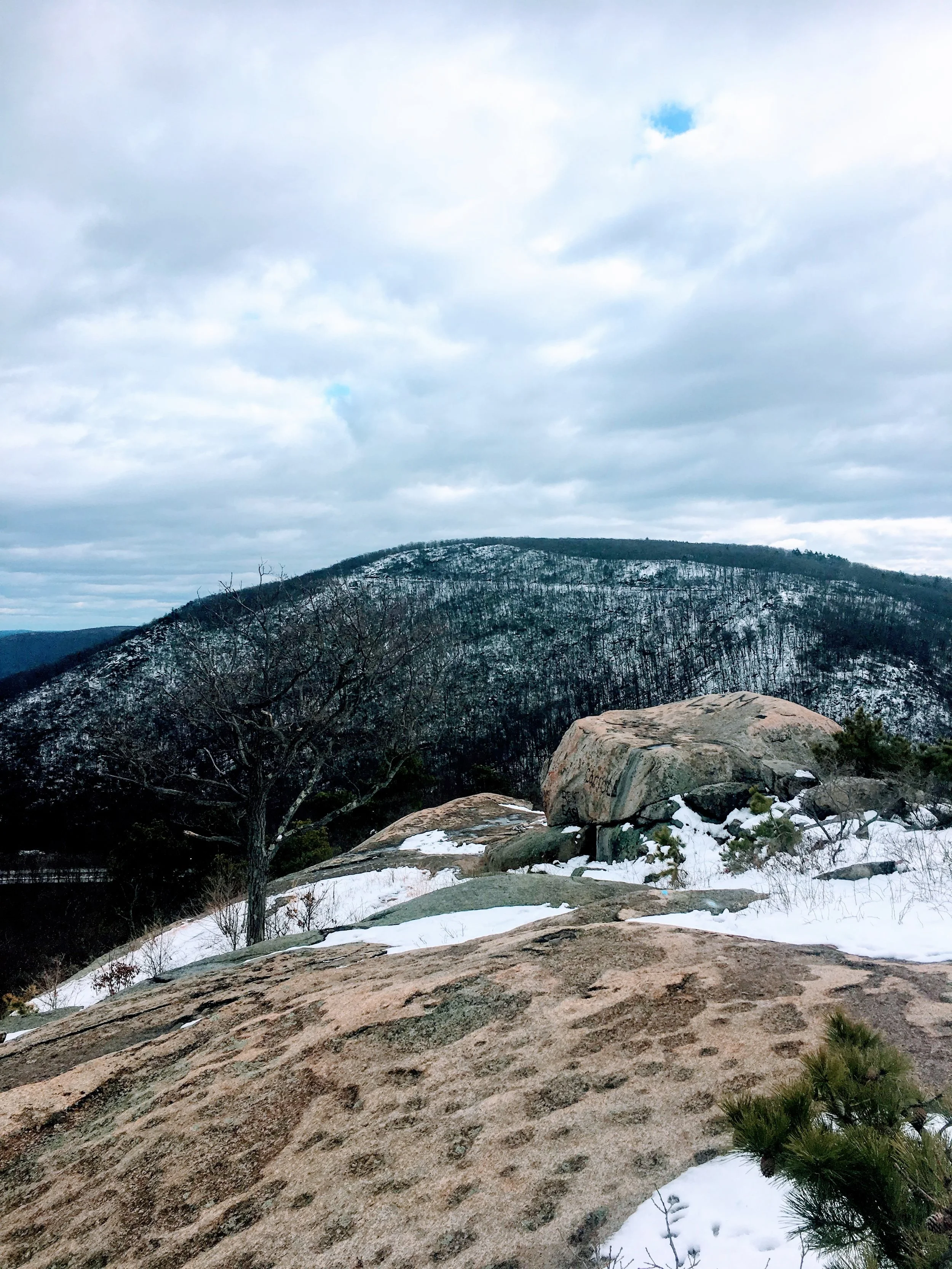
The trek down is probably the hardest part. There is a short but challenging section of rock scrambling, and during the winter and spring, this area has significant mountain runoff. Be careful, where extra traction, and be ready to use your full efforts, scrambling on the way down.
The trek down...toughest part of the hike.
Rock slide from the side angle
Bit of a scramble down
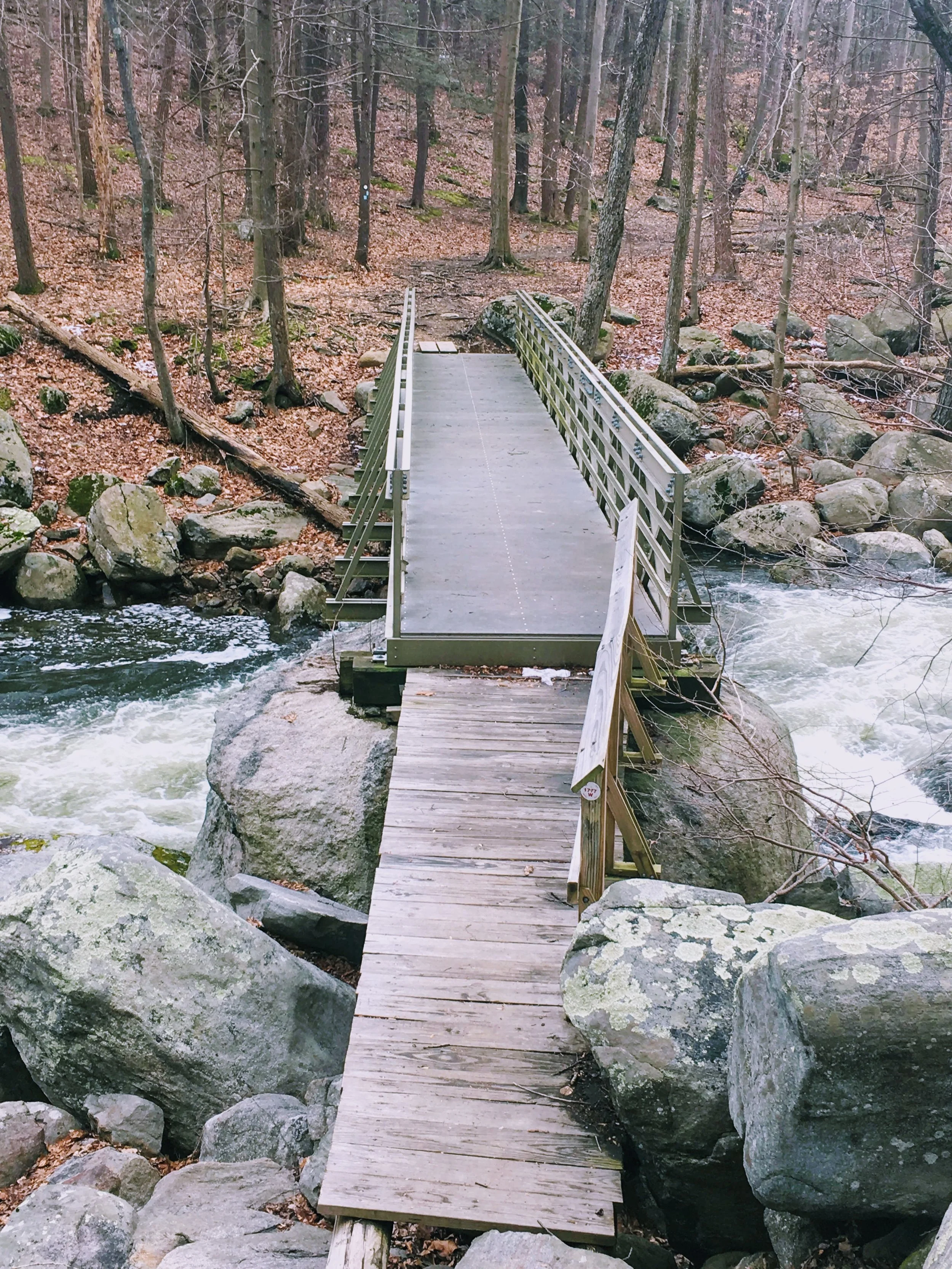
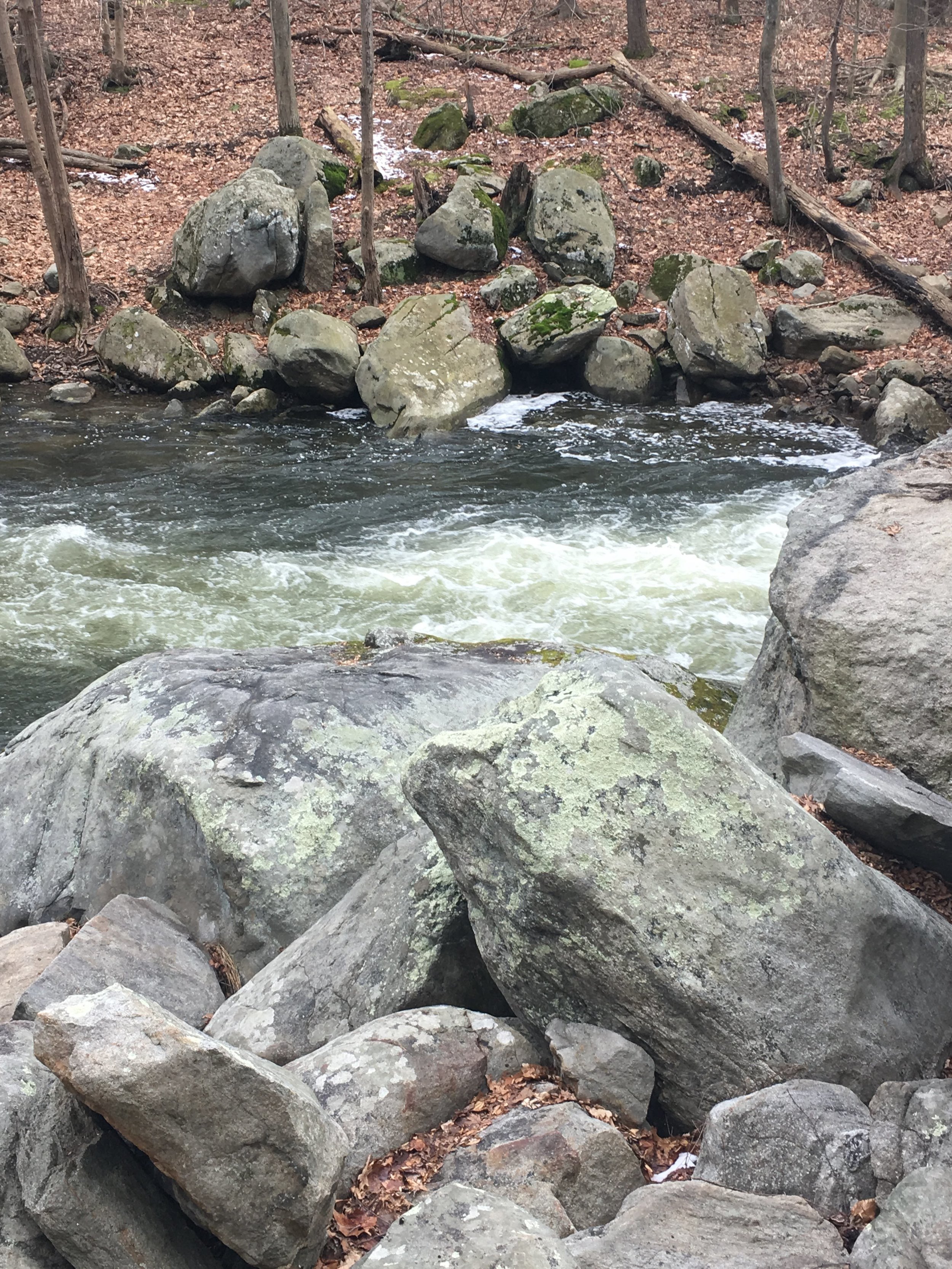
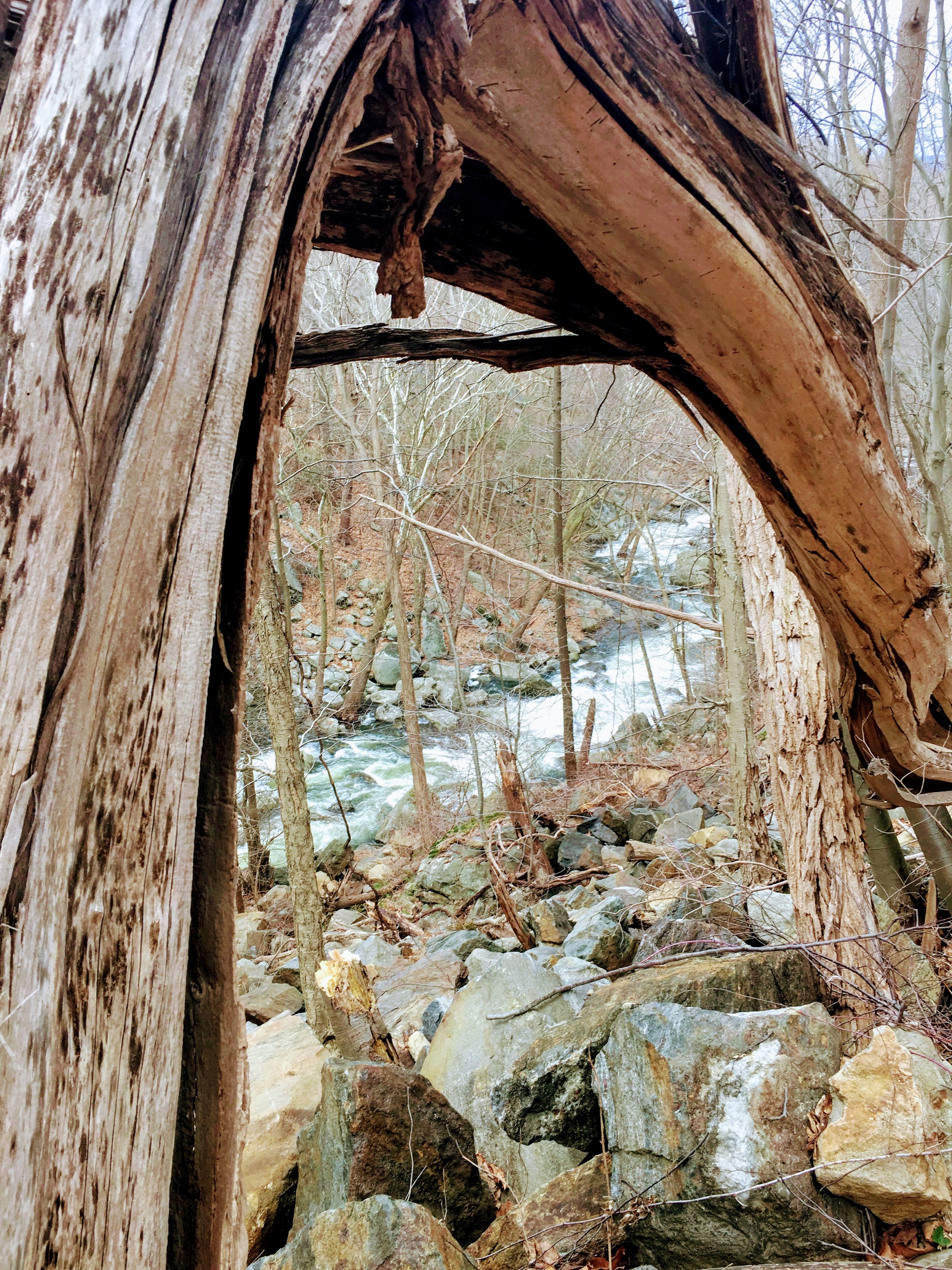
My trip continued for another 2.5 hours because I felt like continuing into the ancillary trails after the descent. Once I hit Mine road (road where parking lot is located) I crossed and continued on the blue 1779 trail. This trial led to a great little footbridge that crossed the Popolopen Creek, which was roaring due to recent Winter Storm Riley. I captured a few good photos and a nice video. I crossed the bridge and took the 1779/1777 (blue/red) west for about 1.5-2 miles (relatively easy trail walking, not much ascent) before turning around, knowing I had to make it back to 9W at some point. At that point, I came to a crossing where I could continue east on the Popolopen Gorge trail (red and white) which is a nice narrow trail that follows mostly along the Popolopen Creek, and is great for trail running (1.8 mile trail). I ran into a family of wild turkeys, they didn't seem to concerned with me.
Footbridge over Popolopen Creek
Thanks to a recent storm, the creek's water flow was intense.
A nice panoramic of the creek along the 77/79 trail heading west.
Finally, I made it to the near-end where there is a nice waterfall and lookout point. Five more minutes and you'll hit 9W. For those of us that want to take an Uber, cross 9W, head east and hang out near the Bear Mountain Bridge, where this is a small parking lot you can hang out in and wait to get picked up.
Overall, this hike is one you can turn into a full day or keep as a quick-hitter depending on your schedule. It's fun, has great panoramic views, includes some scramble and some flat, easy hiking, a great patriotic memorial, waterfalls, wild life, etc. Another great trail in the Hudson Valley, one that I'll be back on in Spring/Summer.
Contact me on my contact page if you have any questions/comments. Thanks!
-Kyle